IZItopo App
The field connected to your office
The Android app for centimeter-level GNSS surveying. Use it standalone, or connected to your office to monitor the site in real time and boost productivity.
Standalone or connected to the office
Two ways to work, depending on your needs
Standalone
The app works on its own: survey, stake out, photograph and export your data locally. No dependency on the office.
Connected to the office
Field and office share the same project in real time. The office tracks progress and updates the plans, which flow straight back down to the tablet.
Two modes in the field
Topo mode to survey and stake out, Photogrammetry mode for photo capture
Topo mode
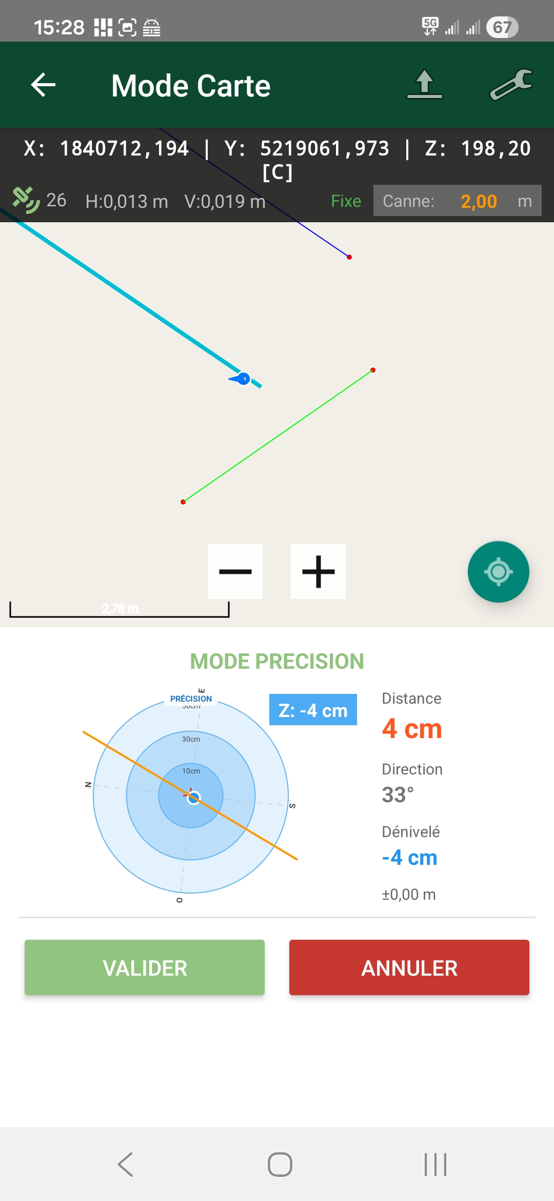
The heart of the product: a full-screen map where everything happens. Pole survey, guided staking and plan visualization brought together in a single mode.
Photogrammetry mode
Timed, GPS-synchronized photo capture to feed your photogrammetric processing.
Features
Everything you need to survey, stake out and document in the field
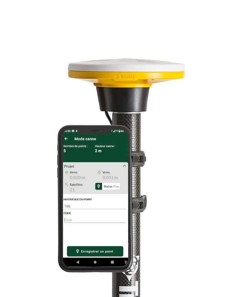
Centimeter survey on the map
Measure your points directly on the map, with customizable coding and multiple measurements to make every reading reliable.
Multi-layer map
Plan or satellite, DXF by layers, orthophoto, points already surveyed and field photos: all your layers stacked and filterable.
Guided staking
Import a DXF or a simple TXT file, pick a point and let the app guide you: directional arrow then precision target. Deviations computed and exported.
High-precision control points
Extended acquisition with statistical filtering of outliers, for a reliable coordinate and real horizontal and vertical accuracies.
Geo-referenced, oriented photos
Each photo is positioned (GPS) and oriented (compass), visible on the map and exported with its metadata.
Coordinate systems & exports
Around twenty projected systems (Lambert 93, CC, UTM…) and standard exports (CSV, DXF) for your professional software.
From field to office, in real time
In connected mode, everything syncs both ways — more productivity, less waiting
Use cases
Topographic and land surveys
Site staking
Network as-built surveys
Real-time site monitoring
Intuitive interface
Designed by surveyors, for surveyors. Every feature has been designed to maximize your productivity in the field.
- Quick to learn, built for the field
- Works standalone or connected to the office
- Android + market GNSS antennas (Trimble, Teria, TMM)
IZItopo App Pricing
Degressive pricing based on the number of licenses
1 to 5 licenses
/license/month
—6 to 10 licenses
/license/month
-25%11 to 25 licenses
/license/month
-44%26 to 50 licenses
/license/month
-63%51 to 100 licenses
/license/month
-70%Degressive, cumulative pricing: the price per license decreases by tier as the number of licenses grows. Example: 10 licenses = €700/month.
Frequently asked questions about IZItopo App
How much does IZItopo App cost?
IZItopo App is a per-license subscription with degressive pricing based on the number of licenses: from €80/license/month for 1 to 5 licenses down to €24/license/month for 51 to 100 licenses. Pricing is cumulative per tier (example: 10 licenses = €700/month). You can simulate your price online.
Can IZItopo App be used without a connection to the office?
Yes. IZItopo App works standalone: survey, staking, photos and local exports, with no dependency on the office. Connected to the IZItopo server, it syncs the project in real time between field and office, both ways.
Which GNSS antennas are compatible with IZItopo App?
IZItopo App works with market GNSS antennas: Trimble (Catalyst, DA2), the Teria network and TMM, plus a test mode. You stay free to choose your equipment, with no proprietary controller.
What devices does IZItopo App run on?
IZItopo App is an Android application (tablet or smartphone), used with a GNSS antenna for centimeter-level RTK positioning.
Can you stake out points with IZItopo App?
Yes. Import your points to stake out as DXF or TXT: the app guides you with a directional arrow then a precision target, and computes the deviations between the theoretical and the measured point.
Ready to revolutionize your field surveys?
Join the professionals who have already adopted IZItopo App to boost their productivity.